Llevant Natural Park Mallorca: Hiking, Coves and Boat Trip
The Llevant Natural Park protects the most unspoilt stretch of Mallorca's northeastern coast, with cliffs over 200 metres high, sea caves and coves with no road access. It is the destination of our Coves and Caves boat trip.
The Llevant Natural Park occupies the northeastern tip of Mallorca and preserves some of the island's least altered stretches of coast. Declared a park in 2001 and extended in 2023, it now protects over 17,000 hectares of land and sea. Many of its coves can only be reached on foot or by boat, and this limited access has given the coastline a character very different from other parts of Mallorca.
Our Coves and Caves boat trip follows this coast from the Port of Alcúdia to Cap Farrutx. For anyone who prefers to discover the park without tackling mountain routes, sailing past its cliffs and coves offers a perspective that is hard to get from land. Our Private Boat Trips also cover this coastline with a more flexible itinerary.
Where it is
The park stretches across the Llevant Peninsula, in northeastern Mallorca, mainly in the municipality of Artà. Parts lie in Sant Llorenç, Capdepera and Santa Margalida.
Its boundaries run from the coast of the Bay of Alcúdia (Son Real) in the north to Cap Farrutx in the east and the Artà mountains in the south. The main peaks are Talaia Freda (564 m), Bec de Ferrutx (519 m) and Puig Morell (563 m).
Quick facts
| Official name | Parc Natural de la Península de Llevant |
| Protection status | Natural Park |
| Year declared | 2001 (extended 2023) |
| Municipalities | Artà, Capdepera, Son Servera, Manacor, Santa Margalida |
| Area | +17,000 ha (land and sea) |
| Land access | Free along signposted trails; entry point: s'Alqueria Vella (Artà) |
| Sea access | Free; anchoring over sand only |
| Facilities available | s'Alqueria Vella Interpretation Centre, refuges, signposted trails |
| Best way to visit | Boat (coast) or hiking from s'Alqueria Vella |
Is it worth visiting?
The park has much to offer anyone seeking wild, undeveloped coastline, anyone who enjoys walking, or anyone wanting to see coves that are not in the travel brochures. Mallorca's northeastern coast is among the least altered in the western Mediterranean, and this is evident as soon as you arrive.
It is less suitable if you want beach facilities, easy access by car or visitor amenities. The coves inside the park have none: no beach bar, no lifeguard and no shower.
If you would rather avoid the mountain routes, cruising this coast by boat lets you discover cliffs, sea caves and coves that stay hidden from anyone who only visits by road.
What is there and what you can see
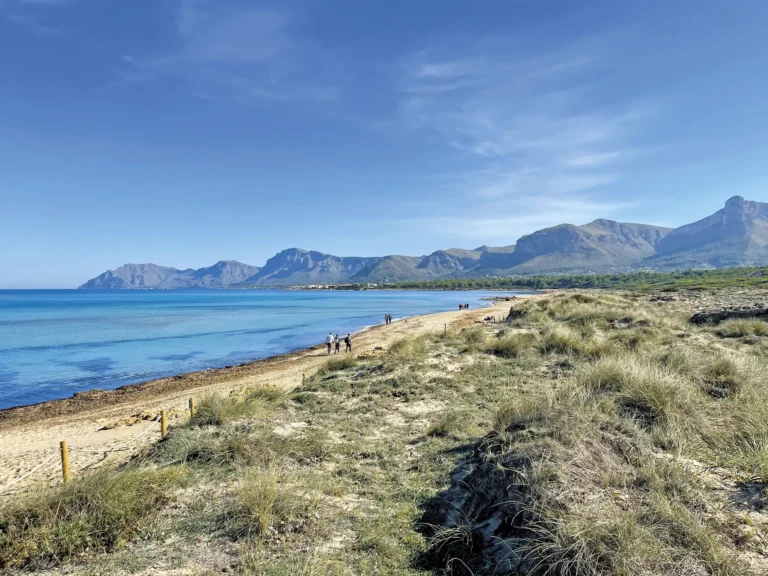
The park's landscape changes between the coast and the interior. From the sea you see cliffs dropping straight into the water, sea caves and small, hard-to-reach coves. From land, the park is mountain country: pine woodland, holm oak groves, garrigue and a network of trails up to the peaks of the Serra de Llevant.
The park's best-known coves are S'Arenalet d'Aubarca (fine sand, surrounded by pine woodland, only on foot 1h30min or by boat), Cala Matzoc (pebbles, next to the Torre d'Albarca of 1751), S'Arenalet de na Clara and Es Caló.
The interior has trails up to the Talaia Freda (564 m), with views over the Bay of Alcúdia and, on clear days, as far as Menorca.
Why is it protected?
The declaration in 2001 came before development pressure reached the Llevant Peninsula. Unlike other protected areas in Mallorca, here the protection prevented the damage before it happened.
The park exists for three concrete reasons.
Eleonora's falcon, the cinereous vulture and the booted eagle share the same space. The endemic flora (Balearic glebia, Mallorcan viper's bugloss) lives in the garrigue without competition from invasive species. It is rare in the western Mediterranean to find this level of biodiversity so close to tourist areas.
The park's coves have posidonia in good condition, with underwater visibility of 15-20 metres. That only holds with active protection: posidonia regenerates very slowly and a badly placed anchor can destroy square metres that would take years to recover.
The coast itself is another reason. The park's cliffs and coves are among the most intact stretches of the western Mediterranean because its protected status preserved them while the rest of the coast was being transformed.
How to get there
By land
The entry point is the s'Alqueria Vella de Baix Interpretation Centre, in Artà. Before entering the park, stop here to pick up maps and check the state of the trails.
Opening hours: 9:00-16:00 (November to March) / 9:00-18:00 (April to October)
Phone: +34 606 09 68 30
Guided visits: Saturdays, with prior booking by phone
| S'Arenalet d'Aubarca from s'Alqueria | ~6 km one way · ~1h 30min · Moderate |
| Talaia Freda + S'Arenalet des Verger (circular) | 19.8 km · ~6h 20min · High |
| Talaia Freda short variant (circular) | 7.2 km · ~2h 30min · Moderate-high |
By sea
Our Coves and Caves Boat Trip departs from the Port of Alcúdia and follows the coast to Cap Farrutx. Along the way it visits sea caves and stops at coves for swimming. The voyage takes about 30 minutes of sailing from Alcúdia to Cap Farrutx, with 45 minutes in the Es Caló area to explore.
Our private boat trips also cover this coast and offer more time in the coves.
Anchoring for private boats is restricted to sandy bottoms.
Rules you should know
Fires, camping outside authorised areas, collecting flora or fauna, and straying off signposted paths are prohibited. Sea fishing within the park is regulated. Anchoring over sand only.
What it looks like from the sea
From the sea, your perception of the park changes completely. The cliffs show their full height, the caves only reveal their size as you approach, and you appreciate the continuity of a coast where hardly a building appears for kilometres.
S'Arenalet d'Aubarca appears first as a gap between the cliffs before the beach hidden behind the pines comes into view. It is also easier to make out the changing colours of the water over the posidonia. And the scale of Cap Farrutx, with its 200 metres of cliff dropping straight into the sea, is something hard to imagine from land.
When to go
For hiking: spring (April-June) and autumn (September-October). In summer the heat on the mountain routes can be punishing. Some tracks may close due to fire risk.
To cruise the coast by boat, April to October. June and September usually offer an excellent balance of sea conditions, temperature and visitor numbers.
Practical tips
Always stop at the s'Alqueria Vella Interpretation Centre before taking the mountain routes. Carry plenty of water, mountain footwear and a downloaded map, as coverage is patchy across much of the park.
The coves in the interior have no facilities at all. Take back everything you bring.
Frequently asked questions
Can you enter freely?
Yes. The park has free access along signposted trails. The Interpretation Centre is the recommended starting point.
Are there signposted trails?
Yes. The centre provides maps. The long routes to Talaia Freda or the coast require good fitness and mountain footwear.
Can you anchor inside the park?
Only over sandy bottoms. Anchoring over posidonia is prohibited.
What wildlife can you see?
Common: Eleonora's falcon, shag cormorant, Mallorcan wild goat. Occasional: sea turtles in summer, dolphins in open water, booted eagle, cinereous vulture.
Are there facilities or do you need to bring everything?
The coves in the interior have no facilities at all. Bring water, food, sun protection and a bag for your rubbish.
How do you get there from the sea?
Our Coves and Caves Boat Trip departs from the Port of Alcúdia and follows the park's coastline.
When is the Interpretation Centre open?
November to March: 9:00-16:00. April to October: 9:00-18:00. Phone: 606 09 68 30.

Artà is a municipality in northeastern Mallorca with an inland old town and an unspoilt coastline. It is not a beach town but a gateway to the Llevant Natural Park and the wildest coves of the east coast.
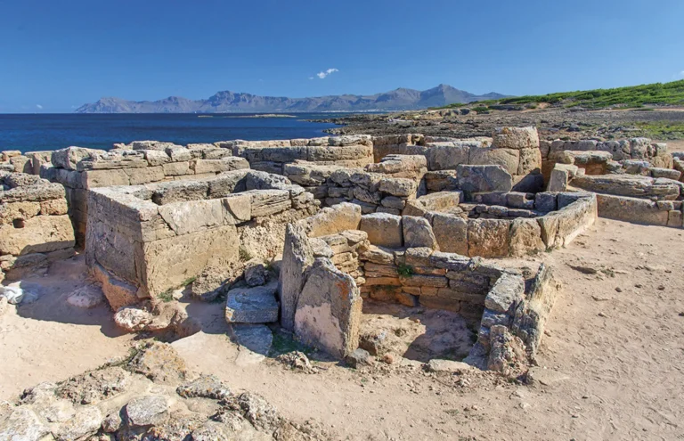
The Necropolis of Son Real is one of Mallorca’s most important archaeological sites, with 143 Talayotic tombs on the coast of the Bay of Alcúdia. It sits just metres from the sea and can be seen from our boat trips.

150 metres from Alcanada beach lies a 4-hectare islet covered in pines and crowned by the Aucanada Lighthouse, in service since 1861. The water around it is among the clearest in the Bay of Alcúdia, thanks to the posidonia meadows.

The Port of Alcúdia is the departure point for all our boat trips and also a destination in its own right: seafront promenade, restaurants and direct access to the beach. In July and August the parking fills up before 10:00.

The Bay of Pollença is the most nautical bay in northern Mallorca. Sheltered by Cap Pinar and the Formentor Peninsula, it has calm waters almost all year round and unspoilt coves reachable only from the sea or on foot.

The Punta de l’Avançada Lighthouse stands at the tip of the point, inside a military zone closed to the public since 1940. It can only be seen from the sea.